
What a landscape can tell you. And what it can’t.
Circular fields, roads and open space invite a closer look. Use an aerial view to form better questions, without mistaking it for proof.
Written
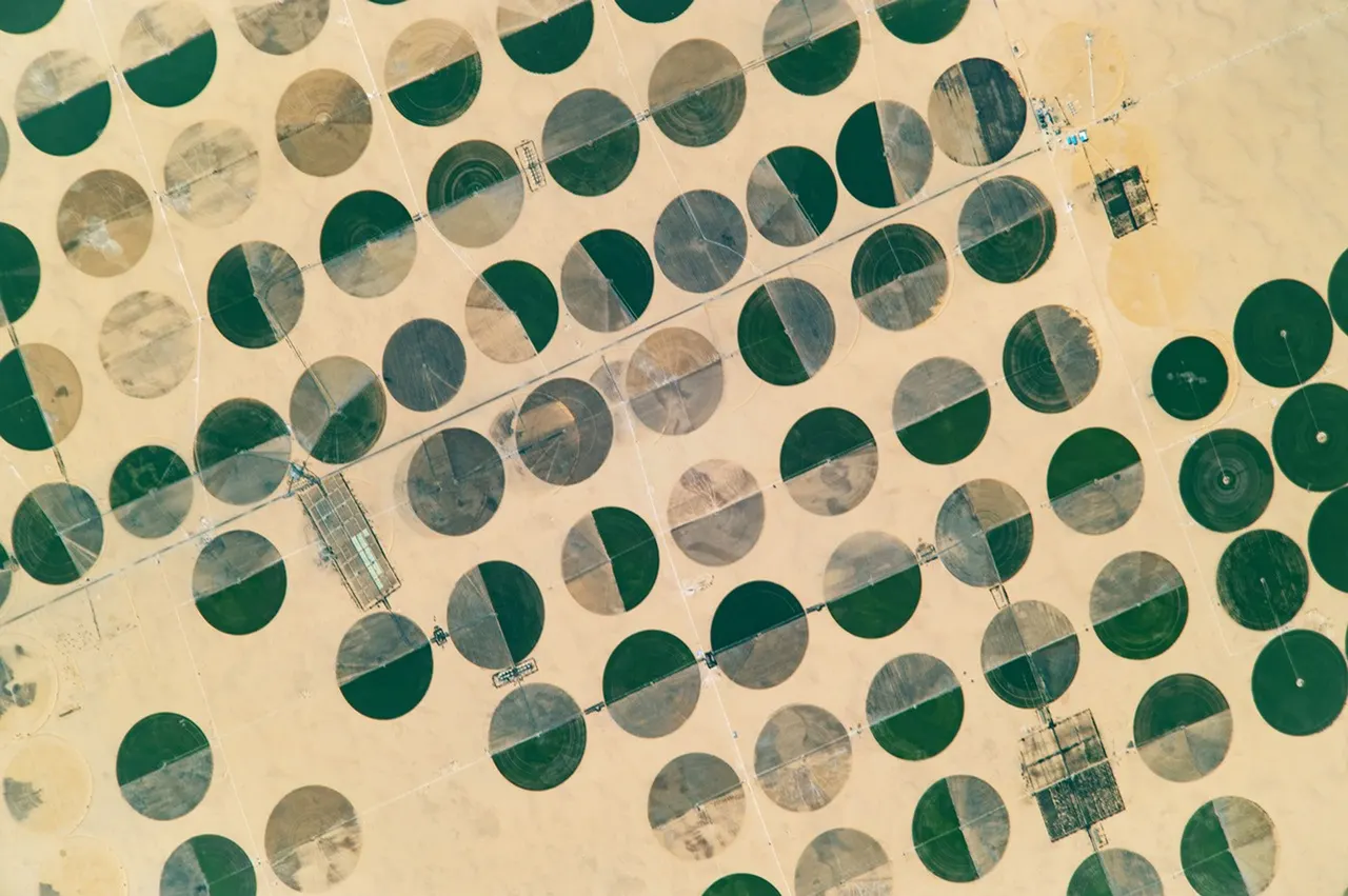
NASA / ISS Crew Earth Observations, Johnson Space Center · ISS049-E-33726. Image record · Usage terms
Start with what is visible
From above, land becomes a pattern of shapes, routes and distances. A cluster of circular fields can stand out against a desert, while a road can connect places that look isolated at first glance. Those patterns make a good starting point for exploration.
The photograph here shows agricultural circles at Sharq El Owainat in southwest Egypt. It was taken from the International Space Station in October 2016. The circular pattern is associated with centre-pivot irrigation: equipment rotates around a central water source. This is a historical example, not evidence of a parcel currently offered on Orbitty.
Turn observations into questions
When you open a land listing, separate what you can see from what you need to establish. A visible route prompts a question about legal access. A green field prompts questions about the water supply and how it is managed. Nearby buildings prompt questions about which services can actually reach the parcel.
A useful habit is to make two short lists: observations from the map, and facts that still need a reliable source. Keep the image date with your notes when the provider supplies it. A photograph records one moment; the land and its surroundings may have changed.
- A track appears to reach the land: who can use it, and on what terms?
- Fields look cultivated: what evidence is available about water, soil and current use?
- Buildings or infrastructure appear nearby: what can actually be connected, and at what cost?
- An outline follows a fence: what do the official parcel records and a qualified survey establish?
Keep the layers separate
On Orbitty, third-party map imagery gives context. A seller-provided public outline helps you locate a listing approximately. An asking price records the advertiser’s offer. These are different pieces of information with different limits.
Neither a convincing image nor a neat polygon establishes ownership, a legal boundary, permission to build or eligibility to buy. Use official records and qualified local professionals for decisions that depend on those facts. Our boundary Field Guide explains the distinction in more detail.
Explore before narrowing your search
Start at a wider scale to understand the surrounding area, then move closer to the listing. Compare the written location with the map and read the details before making an enquiry. Orbitty Earth offers another way to explore terrain and surroundings; it does not add legal certainty to the map.
If a listing’s location or outline seems misleading, use its Report a concern control. Clear observations and the public listing reference are more useful than speculation. Avoid including private documents or personal information in public text.
Sources and scope
General information, not legal, survey, tax or investment advice. Availability and requirements vary by location and listing.